
Avoca topographic map
Interactive map
Click on the map to display elevation.
About this map
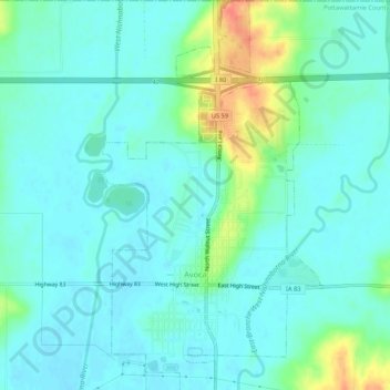
Name: Avoca topographic map, elevation, terrain.
Location: Avoca, Pottawattamie County, Iowa, 51521, United States (41.46570 -95.35226 41.50582 -95.32225)
Average elevation: 1,158 ft
Minimum elevation: 1,119 ft
Maximum elevation: 1,293 ft
Pottawattamie County trails, hiking, mountain biking, running and outdoor activities
Other topographic maps
Click on a map to view its topography, its elevation and its terrain.
Underwood
United States > Iowa > Pottawattamie County > Underwood > Underwood
Average elevation: 1,129 ft