
Jahra Governorate topographic map
Interactive map
Click on the map to display elevation.
About this map
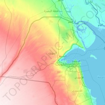
Name: Jahra Governorate topographic map, elevation, terrain.
Location: Jahra Governorate, Kuwait (28.62800 46.55268 30.10381 48.58173)
Average elevation: 509 ft
Minimum elevation: -10 ft
Maximum elevation: 1,145 ft
Other topographic maps
Click on a map to view its topography, its elevation and its terrain.