
Danville topographic map
Interactive map
Click on the map to display elevation.
About this map
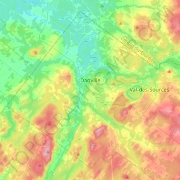
Name: Danville topographic map, elevation, terrain.
Location: Danville, Les Sources, Estrie, Quebec, Canada (45.69880 -72.13377 45.85342 -71.88021)
Average elevation: 673 ft
Minimum elevation: 322 ft
Maximum elevation: 1,283 ft
Other topographic maps
Click on a map to view its topography, its elevation and its terrain.
Val-des-Sources
Canada > Quebec > Les Sources
Val-des-Sources, Les Sources, Estrie, Quebec, Canada
Average elevation: 758 ft