
Arapaho National Forest topographic map
Interactive map
Click on the map to display elevation.
About this map
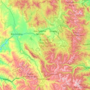
Name: Arapaho National Forest topographic map, elevation, terrain.
Average elevation: 9,688 ft
Minimum elevation: 6,916 ft
Maximum elevation: 14,232 ft