
Futuna topographic map
Interactive map
Click on the map to display elevation.
About this map
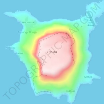
Name: Futuna topographic map, elevation, terrain.
Location: Futuna, Tafea, Vanuatu (-19.54949 170.19555 -19.50860 170.23826)
Average elevation: 489 ft
Minimum elevation: -7 ft
Maximum elevation: 2,152 ft
Other topographic maps
Click on a map to view its topography, its elevation and its terrain.
TAFEA Provincial Disaster Committee
TAFEA Provincial Disaster Committee, Nakepau, Lénakel, Tafea, Vanuatu
Average elevation: 240 ft