
Alto Boquete topographic map
Interactive map
Click on the map to display elevation.
About this map
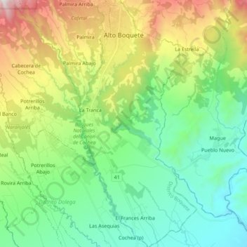
Name: Alto Boquete topographic map, elevation, terrain.
Location: Alto Boquete, Distrito de Boquete, Chiriquí, Panama (8.59493 -82.46253 8.76128 -82.37978)
Average elevation: 2,339 ft
Minimum elevation: 669 ft
Maximum elevation: 6,168 ft
Other topographic maps
Click on a map to view its topography, its elevation and its terrain.
Embalse Río Caldera
Panama > Chiriquí > Distrito de Boquete > Alto Boquete
Average elevation: 3,537 ft