
Ottumwa topographic map
Interactive map
Click on the map to display elevation.
About this map
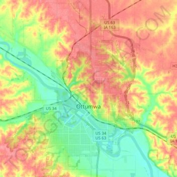
Name: Ottumwa topographic map, elevation, terrain.
Location: Ottumwa, Wapello County, Iowa, 52501, United States (40.97412 -92.46723 41.08814 -92.37344)
Average elevation: 741 ft
Minimum elevation: 614 ft
Maximum elevation: 860 ft
Wapello County trails, hiking, mountain biking, running and outdoor activities