
Lumberton topographic map
Interactive map
Click on the map to display elevation.
About this map
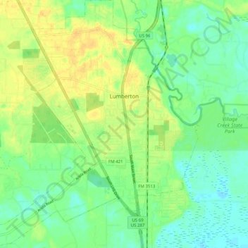
Name: Lumberton topographic map, elevation, terrain.
Location: Lumberton, Hardin County, Texas, United States (30.21258 -94.26117 30.29883 -94.16908)
Average elevation: 43 ft
Minimum elevation: 3 ft
Maximum elevation: 85 ft
Hardin County trails, hiking, mountain biking, running and outdoor activities
Other topographic maps
Click on a map to view its topography, its elevation and its terrain.