
Schertz topographic map
Interactive map
Click on the map to display elevation.
About this map
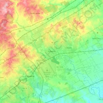
Name: Schertz topographic map, elevation, terrain.
Location: Schertz, Guadalupe County, Texas, 78154, United States (29.46805 -98.30602 29.65928 -98.17674)
Average elevation: 761 ft
Minimum elevation: 571 ft
Maximum elevation: 1,086 ft
Guadalupe County trails, hiking, mountain biking, running and outdoor activities
Other topographic maps
Click on a map to view its topography, its elevation and its terrain.