
Rancho Santa Fe topographic map
Interactive map
Click on the map to display elevation.
Rancho Santa Fe
The climate of Rancho Santa Fe is, for the most part, typical of the San Diego metropolitan area though its higher elevation and inland location lends itself to larger temperature variations.
About this map
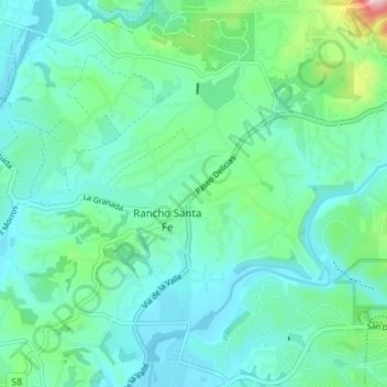
Name: Rancho Santa Fe topographic map, elevation, terrain.
Average elevation: 223 ft
Minimum elevation: 20 ft
Maximum elevation: 1,086 ft