
Kirksville topographic map
Interactive map
Click on the map to display elevation.
About this map
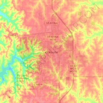
Name: Kirksville topographic map, elevation, terrain.
Location: Kirksville, Adair County, Missouri, 63501, United States (40.13901 -92.61020 40.25230 -92.54195)
Average elevation: 935 ft
Minimum elevation: 787 ft
Maximum elevation: 1,001 ft
Adair County trails, hiking, mountain biking, running and outdoor activities
Other topographic maps
Click on a map to view its topography, its elevation and its terrain.