
Haines City topographic map
Interactive map
Click on the map to display elevation.
About this map
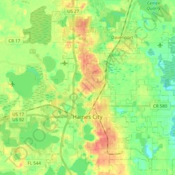
Name: Haines City topographic map, elevation, terrain.
Location: Haines City, Polk County, Florida, 33844, United States (28.06647 -81.66950 28.18674 -81.55065)
Average elevation: 131 ft
Minimum elevation: 62 ft
Maximum elevation: 226 ft
Polk County trails, hiking, mountain biking, running and outdoor activities
Other topographic maps
Click on a map to view its topography, its elevation and its terrain.
Lakeland Highlands
United States > Florida > Polk County > Lakeland Highlands
Average elevation: 210 ft