
Toccoa topographic map
Interactive map
Click on the map to display elevation.
About this map
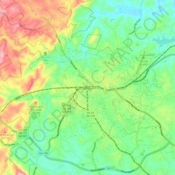
Name: Toccoa topographic map, elevation, terrain.
Location: Toccoa, Stephens County, Georgia, 30577, United States (34.53040 -83.37999 34.62502 -83.27630)
Average elevation: 994 ft
Minimum elevation: 679 ft
Maximum elevation: 1,562 ft
Altitude is 313 m (1,027 ft).
Other topographic maps
Click on a map to view its topography, its elevation and its terrain.
Martin
United States > Georgia > Stephens County
Martin, Stephens County, Georgia, United States
Average elevation: 850 ft
Lake Hartwell
United States > Georgia > Stephens County > Hartwell
Lake Hartwell, Hartwell, Stephens County, Georgia, United States
Average elevation: 879 ft
Toccoa
United States > Georgia > Stephens County > Toccoa > Toccoa
Toccoa, Stephens County, Georgia, 30577, United States
Average elevation: 981 ft