Geolocate

Rochester topographic map

Click on the map to display elevation.

About this map

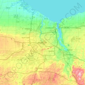
Name: Rochester topographic map, elevation, terrain.

Location: Rochester, Monroe County, New York, 14614, USA (42.99729 -77.77521 43.31729 -77.45521)

Average elevation: 459 ft

Minimum elevation: 230 ft

Maximum elevation: 932 ft

Gear up for your next adventure:

🗃️Trail First Aid Kit - Essential kit for outdoor injuries and emergencies
🦺Reflective Outdoor Gear - Safety gear for low‑light conditions
🍳Camping Cook Set - Complete cookware for outdoor meals
🔥Fast-Boil Camping Stoves - Efficient cooking systems for quick trail meals
🚑Emergency Bivvies - Heat-reflective sleeping bags for survival situations

As an Amazon Associate, this site earns from qualifying purchases at no extra cost to you.