
Jackson topographic map
Interactive map
Click on the map to display elevation.
About this map
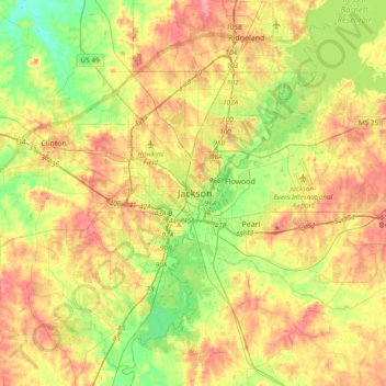
Name: Jackson topographic map, elevation, terrain.
Location: Jackson, Hinds County, Mississippi, 39269, United States (32.13904 -90.34477 32.45904 -90.02477)
Average elevation: 318 ft
Minimum elevation: 184 ft
Maximum elevation: 466 ft
Mississippi trails, hiking, mountain biking, running and outdoor activities