
Platte City topographic map
Interactive map
Click on the map to display elevation.
About this map
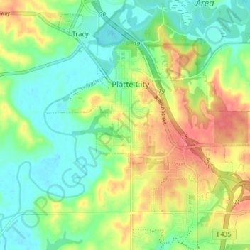
Name: Platte City topographic map, elevation, terrain.
Location: Platte City, Platte County, Missouri, 64079, United States (39.33916 -94.80335 39.37738 -94.73344)
Average elevation: 856 ft
Minimum elevation: 755 ft
Maximum elevation: 1,014 ft
Platte County trails, hiking, mountain biking, running and outdoor activities
Other topographic maps
Click on a map to view its topography, its elevation and its terrain.