
Frankfort topographic map
Interactive map
Click on the map to display elevation.
About this map
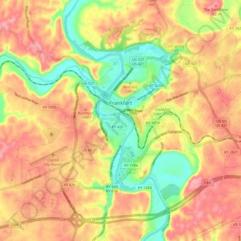
Name: Frankfort topographic map, elevation, terrain.
Location: Frankfort, Franklin County, Kentucky, United States (38.15784 -84.92145 38.23105 -84.80961)
Average elevation: 709 ft
Minimum elevation: 456 ft
Maximum elevation: 909 ft
Franklin County trails, hiking, mountain biking, running and outdoor activities