Albemarle topographic map
Click on the map to display elevation.
Albemarle
The city is centered on the junction of U.S. Route 52 and the duplexed NC-24/27 in the Piedmont Region of North Carolina. Its topography is characterized by rolling, eroded hills, deciduous forests, and fast-running, narrow, shallow streams that feed the Yadkin/Pee Dee River Basin. Little Long Creek and Town Creek are the major non-seasonal streams through Albemarle; both flow generally southward into the Long and Big Bear Creek Sub-basin.
About this map
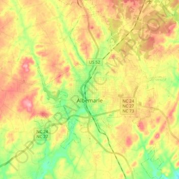
Name: Albemarle topographic map, elevation, terrain.
Average elevation: 545 ft
Minimum elevation: 331 ft
Maximum elevation: 751 ft
Stanly County trails, hiking, mountain biking, running and outdoor activities
Other topographic maps
Click on a map to view its topography, its elevation and its terrain.