
Abilene topographic map
Interactive map
Click on the map to display elevation.
About this map
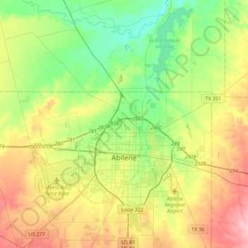
Name: Abilene topographic map, elevation, terrain.
Location: Abilene, Taylor County, Texas, United States (32.34319 -99.86759 32.62448 -99.62308)
Average elevation: 1,749 ft
Minimum elevation: 1,578 ft
Maximum elevation: 2,018 ft
Taylor County trails, hiking, mountain biking, running and outdoor activities
Other topographic maps
Click on a map to view its topography, its elevation and its terrain.