
Radford City topographic map
Interactive map
Click on the map to display elevation.
About this map
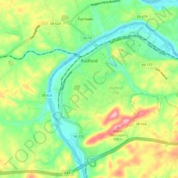
Name: Radford City topographic map, elevation, terrain.
Location: Radford, Radford City, Virginia, United States (37.08960 -80.59639 37.15106 -80.50698)
Average elevation: 1,916 ft
Minimum elevation: 1,690 ft
Maximum elevation: 2,300 ft
Virginia trails, hiking, mountain biking, running and outdoor activities