
Metairie topographic map
Interactive map
Click on the map to display elevation.
About this map
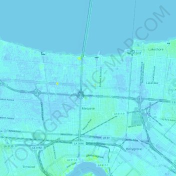
Name: Metairie topographic map, elevation, terrain.
Location: Metairie, Jefferson Parish, Louisiana, United States (29.96884 -90.23762 30.03437 -90.12112)
Average elevation: 3 ft
Minimum elevation: -10 ft
Maximum elevation: 62 ft
Jefferson Parish trails, hiking, mountain biking, running and outdoor activities
Other topographic maps
Click on a map to view its topography, its elevation and its terrain.