
Findlay topographic map
Interactive map
Click on the map to display elevation.
Findlay
Findlay is situated on relatively flat terrain within the northwest region of the state, characterized by gently rolling hills and fertile plains. The city lies at an elevation of approximately 800 feet (244 meters) above sea level, with the Blanchard River meandering through the area, contributing to the landscape's gentle undulations. The surrounding region features rich agricultural land, making it well-suited for farming, while nearby woodlands and small parks provide pockets of natural beauty. This topography, combined with the river's proximity, creates a picturesque environment that supports both urban development and outdoor recreational opportunities.
About this map
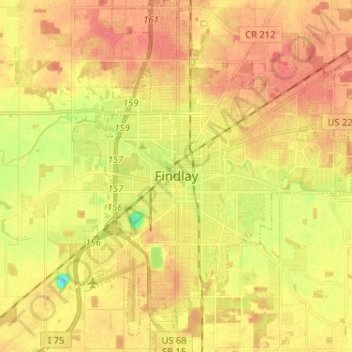
Name: Findlay topographic map, elevation, terrain.
Location: Findlay, Hancock County, Ohio, United States (40.99265 -83.68940 41.08993 -83.57347)
Average elevation: 797 ft
Minimum elevation: 692 ft
Maximum elevation: 856 ft
Hancock County trails, hiking, mountain biking, running and outdoor activities
Other topographic maps
Click on a map to view its topography, its elevation and its terrain.