
Iztacalco topographic map
Interactive map
Click on the map to display elevation.
About this map
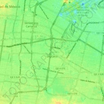
Name: Iztacalco topographic map, elevation, terrain.
Location: Iztacalco, Mexico City, Mexico (19.37570 -99.13718 19.42223 -99.05579)
Average elevation: 7,323 ft
Minimum elevation: 7,283 ft
Maximum elevation: 7,359 ft
Other topographic maps
Click on a map to view its topography, its elevation and its terrain.