Tiffin topographic map
Interactive map
Click on the map to display elevation.
About this map
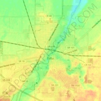
Name: Tiffin topographic map, elevation, terrain.
Location: Tiffin, Seneca County, Ohio, 44883, United States (41.09308 -83.22532 41.14505 -83.14960)
Average elevation: 764 ft
Minimum elevation: 699 ft
Maximum elevation: 814 ft
Other topographic maps
Click on a map to view its topography, its elevation and its terrain.
Fostoria
United States > Ohio > Seneca County
Fostoria, Seneca County, Ohio, 44830, United States
Average elevation: 771 ft
Mohawk Lake
United States > Ohio > Seneca County
Mohawk Lake, Eden Township, Seneca County, Ohio, United States
Average elevation: 787 ft
Green Springs
United States > Ohio > Seneca County
Green Springs, Adams Township, Seneca County, Ohio, United States
Average elevation: 699 ft
Attica
United States > Ohio > Seneca County
Attica, Venice Township, Seneca County, Ohio, United States
Average elevation: 938 ft
Jackson Township
United States > Ohio > Seneca County
Jackson Township, Seneca County, Ohio, United States
Average elevation: 735 ft
Alvada
United States > Ohio > Seneca County
Alvada, Big Spring Township, Seneca County, Ohio, 44802, United States
Average elevation: 843 ft
Saint Stephens
United States > Ohio > Seneca County
Saint Stephens, Venice Township, Seneca County, Ohio, United States
Average elevation: 948 ft
Old Fort
United States > Ohio > Seneca County
Old Fort, Pleasant Township, Seneca County, Ohio, 44861, United States
Average elevation: 682 ft
Bloomville
United States > Ohio > Seneca County
Bloomville, Bloom Township, Seneca County, Ohio, United States
Average elevation: 922 ft