
Hartington topographic map
Interactive map
Click on the map to display elevation.
About this map
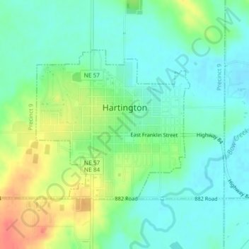
Name: Hartington topographic map, elevation, terrain.
Location: Hartington, Cedar County, Nebraska, United States (42.61257 -97.27761 42.62874 -97.25491)
Average elevation: 1,401 ft
Minimum elevation: 1,339 ft
Maximum elevation: 1,519 ft
Other topographic maps
Click on a map to view its topography, its elevation and its terrain.
Precinct 18
United States > Nebraska > Cedar County
Precinct 18, Cedar County, Nebraska, United States
Average elevation: 1,781 ft