Navasota topographic map
Interactive map
Click on the map to display elevation.
About this map
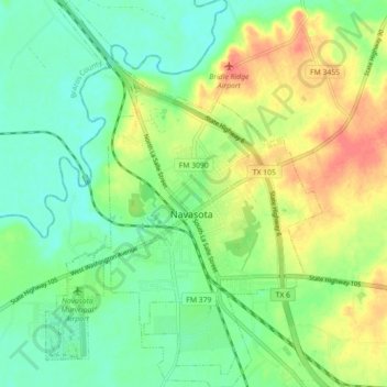
Name: Navasota topographic map, elevation, terrain.
Location: Navasota, Grimes County, Texas, 77868, United States (30.35412 -96.12168 30.43092 -96.05787)
Average elevation: 233 ft
Minimum elevation: 161 ft
Maximum elevation: 344 ft
Other topographic maps
Click on a map to view its topography, its elevation and its terrain.
Plantersville
United States > Texas > Grimes County > Plantersville
Plantersville, Grimes County, Texas, United States
Average elevation: 335 ft
Bedias
United States > Texas > Grimes County
Bedias, Grimes County, Texas, United States
Average elevation: 325 ft
Iola
United States > Texas > Grimes County
Iola, Grimes County, Texas, United States
Average elevation: 331 ft
Navasota
United States > Texas > Grimes County > Navasota > Navasota
Navasota, Grimes County, Texas, 77868, United States
Average elevation: 233 ft