
Thank you for supporting this site ❤️
Make a donation
Make a donation
Gear up for your next adventure:
As an Amazon Associate, this site earns from qualifying purchases at no extra cost to you.
Marraco topographic map
Click on the map to display elevation.
Thank you for supporting this site ❤️
Make a donation
Make a donation
Gear up for your next adventure:
As an Amazon Associate, this site earns from qualifying purchases at no extra cost to you.
About this map
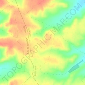
Name: Marraco topographic map, elevation, terrain.
Location: Marraco, Castronuño, Tordesillas, Castile and León, Spain (41.32631 -5.32759 41.34631 -5.30759)
Average elevation: 2,569 ft
Minimum elevation: 2,477 ft
Maximum elevation: 2,635 ft
Thank you for supporting this site ❤️
Make a donation
Make a donation
Gear up for your next adventure:
As an Amazon Associate, this site earns from qualifying purchases at no extra cost to you.