
Richland Center topographic map
Interactive map
Click on the map to display elevation.
About this map
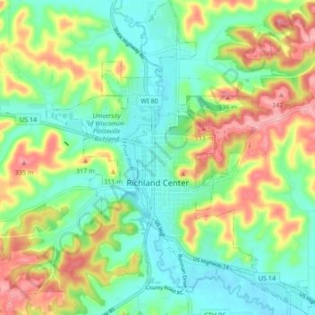
Name: Richland Center topographic map, elevation, terrain.
Location: Richland Center, Richland County, Wisconsin, United States (43.30983 -90.41498 43.37063 -90.34220)
Average elevation: 866 ft
Minimum elevation: 709 ft
Maximum elevation: 1,138 ft
Richland County trails, hiking, mountain biking, running and outdoor activities
Other topographic maps
Click on a map to view its topography, its elevation and its terrain.