
Bondville topographic map
Interactive map
Click on the map to display elevation.
About this map
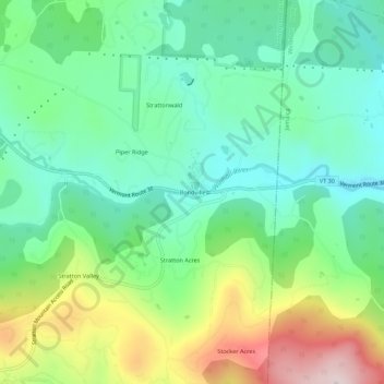
Name: Bondville topographic map, elevation, terrain.
Average elevation: 1,594 ft
Minimum elevation: 1,161 ft
Maximum elevation: 2,503 ft
Bennington County trails, hiking, mountain biking, running and outdoor activities
Other topographic maps
Click on a map to view its topography, its elevation and its terrain.
Gale Meadows Pond
United States > Vermont > Bennington County > Winhall > French Hollow
Average elevation: 1,434 ft