
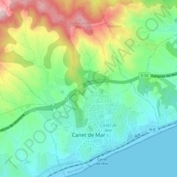
Canet de Mar topographic map
Interactive map
Click on the map to display elevation.
About this map
Name: Canet de Mar topographic map, elevation, terrain.
Location: Canet de Mar, Maresme, Barcelona, Catalonia, 08360, Spain (41.58251 2.55378 41.61464 2.59535)
Average elevation: 335 ft
Minimum elevation: -7 ft
Maximum elevation: 1,014 ft