
New Concord topographic map
Interactive map
Click on the map to display elevation.
About this map
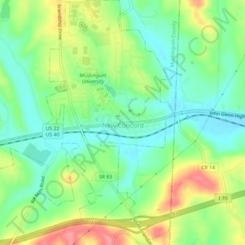
Name: New Concord topographic map, elevation, terrain.
Location: New Concord, Muskingum County, Ohio, 43762, United States (39.97807 -81.75595 40.00958 -81.72529)
Average elevation: 928 ft
Minimum elevation: 817 ft
Maximum elevation: 1,106 ft
Muskingum County trails, hiking, mountain biking, running and outdoor activities
Other topographic maps
Click on a map to view its topography, its elevation and its terrain.