
Davis Mountains State Park topographic map
Interactive map
Click on the map to display elevation.
About this map
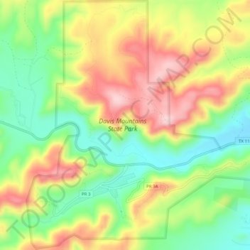
Name: Davis Mountains State Park topographic map, elevation, terrain.
Average elevation: 5,259 ft
Minimum elevation: 4,885 ft
Maximum elevation: 5,692 ft
Jeff Davis County trails, hiking, mountain biking, running and outdoor activities
Other topographic maps
Click on a map to view its topography, its elevation and its terrain.
Sleeping Lion Mountain
United States > Texas > Jeff Davis County > Fort Davis
Average elevation: 4,961 ft