Cochran's Crossing topographic map
Interactive map
Click on the map to display elevation.
About this map
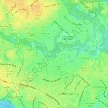
Name: Cochran's Crossing topographic map, elevation, terrain.
Average elevation: 164 ft
Minimum elevation: 118 ft
Maximum elevation: 203 ft

Click on the map to display elevation.
Name: Cochran's Crossing topographic map, elevation, terrain.
Average elevation: 164 ft
Minimum elevation: 118 ft
Maximum elevation: 203 ft