
Marrowbone topographic map
Interactive map
Click on the map to display elevation.
About this map
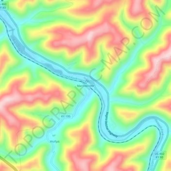
Name: Marrowbone topographic map, elevation, terrain.
Location: Marrowbone, Pike County, Kentucky, 41559, United States (37.34594 -82.43376 37.38594 -82.39376)
Average elevation: 1,122 ft
Minimum elevation: 669 ft
Maximum elevation: 1,670 ft
Pike County trails, hiking, mountain biking, running and outdoor activities
Other topographic maps
Click on a map to view its topography, its elevation and its terrain.