
Menomonee Falls topographic map
Interactive map
Click on the map to display elevation.
About this map
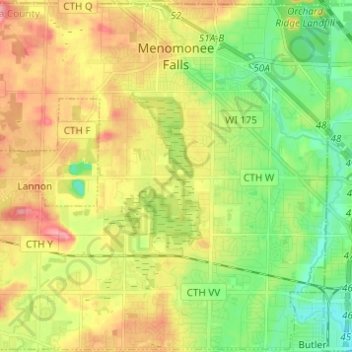
Name: Menomonee Falls topographic map, elevation, terrain.
Location: Menomonee Falls, Waukesha County, Wisconsin, United States (43.10457 -88.18567 43.19261 -88.06336)
Average elevation: 833 ft
Minimum elevation: 705 ft
Maximum elevation: 991 ft
Waukesha County trails, hiking, mountain biking, running and outdoor activities
Other topographic maps
Click on a map to view its topography, its elevation and its terrain.
Menomonee Falls
United States > Wisconsin > Waukesha County > Menomonee Falls
Average elevation: 853 ft