
Quincy topographic map
Interactive map
Click on the map to display elevation.
About this map
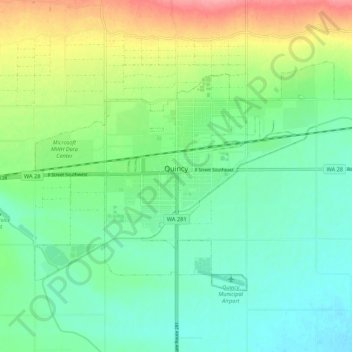
Name: Quincy topographic map, elevation, terrain.
Location: Quincy, Grant County, Washington, United States (47.20901 -119.89663 47.25637 -119.78948)
Average elevation: 1,312 ft
Minimum elevation: 1,224 ft
Maximum elevation: 1,503 ft
Grant County trails, hiking, mountain biking, running and outdoor activities
Other topographic maps
Click on a map to view its topography, its elevation and its terrain.