
Inveruglas topographic map
Interactive map
Click on the map to display elevation.
About this map
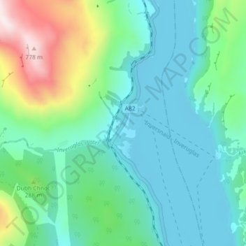
Name: Inveruglas topographic map, elevation, terrain.
Location: Inveruglas, Argyll and Bute, Scotland, G83 7DP, United Kingdom (56.22851 -4.73277 56.26851 -4.69277)
Average elevation: 617 ft
Minimum elevation: 13 ft
Maximum elevation: 2,638 ft