
Centennial topographic map
Interactive map
Click on the map to display elevation.
About this map
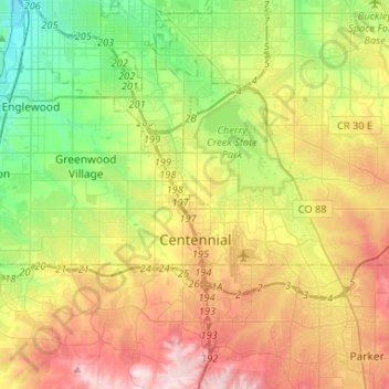
Name: Centennial topographic map, elevation, terrain.
Location: Centennial, Arapahoe County, Colorado, United States (39.56599 -104.98839 39.63842 -104.72620)
Average elevation: 5,699 ft
Minimum elevation: 5,226 ft
Maximum elevation: 6,362 ft
Arapahoe County trails, hiking, mountain biking, running and outdoor activities
Other topographic maps
Click on a map to view its topography, its elevation and its terrain.
Littleton
United States > Colorado > Arapahoe County > Littleton > Littleton
Littleton is located at 39°35′59″N 105°0′39″W / 39.59972°N 105.01083°W / 39.59972; -105.01083 (39.599691, −105.010929) at an elevation of 5,351 feet (1,631 m). Located in central Colorado at the junction of U.S. Route 85 and Colorado State Highway 470, the city is 9 miles (14 km) south…
Average elevation: 5,433 ft