
Easton topographic map
Interactive map
Click on the map to display elevation.
About this map
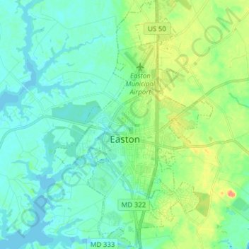
Name: Easton topographic map, elevation, terrain.
Location: Easton, Talbot County, Maryland, 21601, United States (38.73122 -76.11212 38.82911 -76.03203)
Average elevation: 33 ft
Minimum elevation: -3 ft
Maximum elevation: 112 ft
Talbot County trails, hiking, mountain biking, running and outdoor activities
Other topographic maps
Click on a map to view its topography, its elevation and its terrain.