
Huangpu District topographic map
Interactive map
Click on the map to display elevation.
About this map
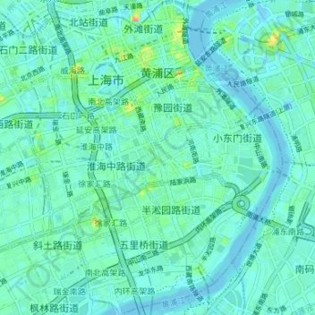
Name: Huangpu District topographic map, elevation, terrain.
Location: Huangpu District, Shanghai, China (31.19020 121.45220 31.24631 121.50596)
Average elevation: 30 ft
Minimum elevation: -20 ft
Maximum elevation: 161 ft
Other topographic maps
Click on a map to view its topography, its elevation and its terrain.