
Westminster topographic map
Interactive map
Click on the map to display elevation.
About this map
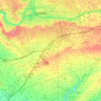
Name: Westminster topographic map, elevation, terrain.
Location: Westminster, London, Southwestern Ontario, Ontario, Canada (42.82457 -81.37083 42.98677 -81.08655)
Average elevation: 850 ft
Minimum elevation: 709 ft
Maximum elevation: 1,033 ft
Other topographic maps
Click on a map to view its topography, its elevation and its terrain.