
Dyersville topographic map
Interactive map
Click on the map to display elevation.
About this map
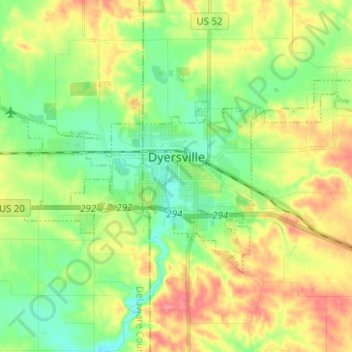
Name: Dyersville topographic map, elevation, terrain.
Location: Dyersville, Dubuque County, Iowa, 52040, United States (42.45396 -91.17509 42.50445 -91.05013)
Average elevation: 1,004 ft
Minimum elevation: 909 ft
Maximum elevation: 1,135 ft
Dubuque County trails, hiking, mountain biking, running and outdoor activities
Other topographic maps
Click on a map to view its topography, its elevation and its terrain.