
Mohave Valley topographic map
Interactive map
Click on the map to display elevation.
About this map
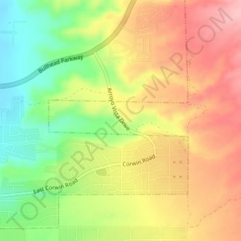
Name: Mohave Valley topographic map, elevation, terrain.
Location: Mohave Valley, Mohave County, Arizona, United States (35.05023 -114.58154 35.05484 -114.56001)
Average elevation: 764 ft
Minimum elevation: 515 ft
Maximum elevation: 984 ft
Mohave County trails, hiking, mountain biking, running and outdoor activities
Other topographic maps
Click on a map to view its topography, its elevation and its terrain.
Fort Mojave Indian Tribe
United States > Arizona > Mohave County > Mohave Valley
Average elevation: 1,188 ft