
Taylors Falls topographic map
Interactive map
Click on the map to display elevation.
About this map
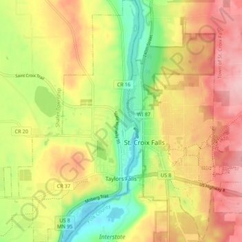
Name: Taylors Falls topographic map, elevation, terrain.
Location: Taylors Falls, Chisago County, Minnesota, United States (45.38678 -92.69236 45.44429 -92.64646)
Average elevation: 961 ft
Minimum elevation: 676 ft
Maximum elevation: 1,230 ft
Chisago County trails, hiking, mountain biking, running and outdoor activities
Other topographic maps
Click on a map to view its topography, its elevation and its terrain.
Chain Lake
United States > Minnesota > Chisago County > North Branch > Harris
Average elevation: 922 ft