
Kershaw topographic map
Interactive map
Click on the map to display elevation.
About this map
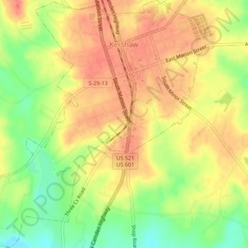
Name: Kershaw topographic map, elevation, terrain.
Location: Kershaw, Lancaster County, South Carolina, United States (34.52569 -80.60428 34.55737 -80.56929)
Average elevation: 479 ft
Minimum elevation: 367 ft
Maximum elevation: 548 ft
Lancaster County trails, hiking, mountain biking, running and outdoor activities