
Branford topographic map
Interactive map
Click on the map to display elevation.
About this map
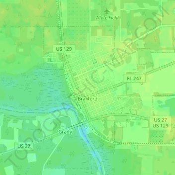
Name: Branford topographic map, elevation, terrain.
Location: Branford, Suwannee County, Florida, United States (29.95136 -82.93608 29.97032 -82.90663)
Average elevation: 33 ft
Minimum elevation: 3 ft
Maximum elevation: 49 ft
Suwannee County trails, hiking, mountain biking, running and outdoor activities