
Huangpu District topographic map
Interactive map
Click on the map to display elevation.
About this map
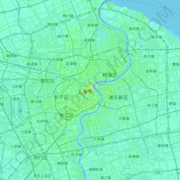
Name: Huangpu District topographic map, elevation, terrain.
Location: Huangpu District, 200002, China (31.07359 121.31986 31.39359 121.63986)
Average elevation: 16 ft
Minimum elevation: -16 ft
Maximum elevation: 138 ft
Other topographic maps
Click on a map to view its topography, its elevation and its terrain.