
Millerton topographic map
Interactive map
Click on the map to display elevation.
About this map
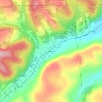
Name: Millerton topographic map, elevation, terrain.
Location: Millerton, Tioga County, Pennsylvania, United States (41.96341 -76.95857 42.00341 -76.91857)
Average elevation: 1,467 ft
Minimum elevation: 1,099 ft
Maximum elevation: 1,867 ft
Pennsylvania trails, hiking, mountain biking, running and outdoor activities