
Village of Brookville topographic map
Interactive map
Click on the map to display elevation.
About this map
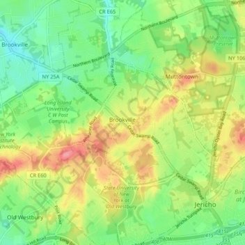
Name: Village of Brookville topographic map, elevation, terrain.
Average elevation: 210 ft
Minimum elevation: 92 ft
Maximum elevation: 367 ft
Nassau County trails, hiking, mountain biking, running and outdoor activities
Other topographic maps
Click on a map to view its topography, its elevation and its terrain.
Valley Stream
United States > New York > Nassau County > Valley Stream > Valley Stream
Average elevation: 30 ft