
Allegheny National Forest topographic map
Interactive map
Click on the map to display elevation.
About this map
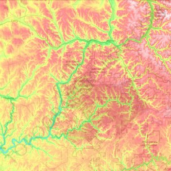
Name: Allegheny National Forest topographic map, elevation, terrain.
Average elevation: 1,631 ft
Minimum elevation: 974 ft
Maximum elevation: 2,274 ft
Warren County trails, hiking, mountain biking, running and outdoor activities
Other topographic maps
Click on a map to view its topography, its elevation and its terrain.
highest point in Warren County PA
United States > Pennsylvania > Warren County
Average elevation: 2,041 ft
Clarendon Heights
United States > Pennsylvania > Warren County > Clarendon Heights
Average elevation: 1,572 ft